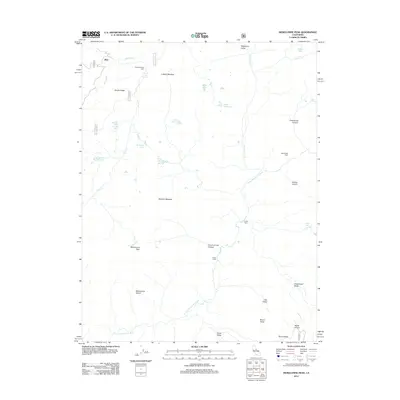
2012 Map of Mokelumne Peak
USGS Topo · Published 2012About this map
Mokelumne Peak and the Mokelumne Tetons dominate this high-elevation landscape in the Sierra Nevada. The terrain is defined by a series of deep canyons and alpine meadows, including Deadwood Canyon and Ladeux Meadow, carved by the N Fork Mokelumne River and its tributaries like Bear River and Summit City Cr. Remote outposts such as the Plasse Trading Post, Monty Wolf Cabin, and Cedar Camp suggest a history of seasonal travel, ranching, and early wilderness commerce.
Find a feature on this map
40 named features on this map. Tap any name to fly to it.
Don’t see what you’re looking for? This feature index may not catch every label — zoom into the map to look around manually.
Map Details
Editions of this 2012 Mokelumne Peak Map
This is the sole edition of this map. No revisions or reprints were ever made.
Other maps of this area

1889 · Pyramid Peak
USGS Topo · 1:125,000

1889 · Markleeville
USGS Topo · 1:125,000

1891 · Markleeville
USGS Topo · 1:125,000

1891 · Big Trees
USGS Topo · 1:125,000

1891 · Pyramid Peak
USGS Topo · 1:125,000

1893 · Markleeville
USGS Topo · 1:125,000

1894 · Big Trees
USGS Topo · 1:125,000

1895 · Pyramid Peak
USGS Topo · 1:125,000

1896 · Dardanelles
USGS Topo · 1:125,000

1896 · Pyramid Peak
USGS Topo · 1:125,000