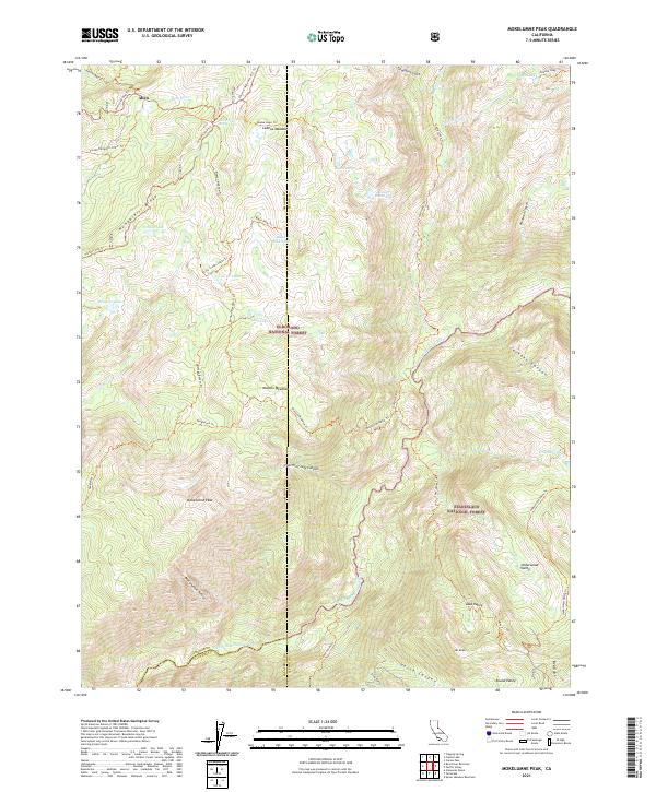
2021 Map of Mokelumne Peak
USGS Topo · Published 2021About this map
Mokelumne Peak dominates this high-altitude landscape within the Eldorado National Forest and Stanislaus National Forest. The map documents a rugged interior where the N Fork Mokelumne River carves through deep terrain, flanked by significant landmarks like Mt Reba and the vast Lake Valley. The presence of historic routes like the Carson Emigrant N.R.T. Trl and various 4WD paths such as the Pardoe 4wd Trl illustrates the region's long-standing use as a transit corridor through the Sierra Nevada.
Find a feature on this map
57 named features on this map. Tap any name to fly to it.
Don’t see what you’re looking for? This feature index may not catch every label — zoom into the map to look around manually.
Map Details
Editions of this 2021 Mokelumne Peak Map
This is the sole edition of this map. No revisions or reprints were ever made.
Other maps of this area

1889 · Pyramid Peak
USGS Topo · 1:125,000

1889 · Markleeville
USGS Topo · 1:125,000

1891 · Markleeville
USGS Topo · 1:125,000

1891 · Big Trees
USGS Topo · 1:125,000

1891 · Pyramid Peak
USGS Topo · 1:125,000

1893 · Markleeville
USGS Topo · 1:125,000

1894 · Big Trees
USGS Topo · 1:125,000

1895 · Pyramid Peak
USGS Topo · 1:125,000

1896 · Dardanelles
USGS Topo · 1:125,000

1896 · Pyramid Peak
USGS Topo · 1:125,000