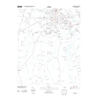
2013 Map of Monroe
USGS Topo · Published 2013About this map
Benton Heights and the surrounding neighborhoods of Sutton Park and Welsh Heights form the residential heart of this area in the early 21st century. The map reveals a dense suburban network of streets and subdivisions, including Sherwood Forest, Franklin Colony, and Carmel Village, illustrating the continued expansion of the local community. To the south and east, the landscape transitions into a more riparian environment shaped by the winding paths of Richardson Cr and its tributaries, such as Bearskin Cr and Little Richardson Cr. Notable water bodies like Lake Monroe and Lake Lee serve as significant landmarks amidst the developed areas. Smaller, outlying communities like Alton and Roughedge appear further from the primary center, while family-named roads and landmarks like Heil Leah suggest the deep-rooted local history of this Piedmont region.
Find a feature on this map
277 named features on this map. Tap any name to fly to it.
Don’t see what you’re looking for? This feature index may not catch every label — zoom into the map to look around manually.
Map Details
Editions of this 2013 Monroe Map
This is the sole edition of this map. No revisions or reprints were ever made.
Other maps of this area

1941 · Charlotte
USGS Topo · 1:125,000

1941 · Spartanburg
USGS Topo · 1:250,000

1942 · Charlotte
USGS Topo · 1:125,000

1953 · Spartanburg
USGS Topo · 1:250,000

1953 · Charlotte
USGS Topo · 1:250,000

1954 · Charlotte
USGS Topo · 1:250,000

1960 · Charlotte
USGS Topo · 1:250,000

1960 · Spartanburg
USGS Topo · 1:250,000

1962 · Charlotte
USGS Topo · 1:250,000

1963 · Spartanburg
USGS Topo · 1:250,000