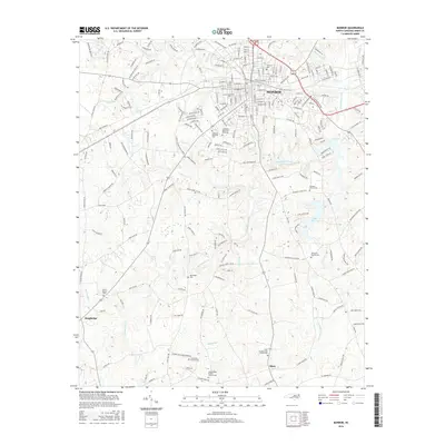
2016 Map of Monroe
USGS Topo · Published 2016About this map
Monroe serves as the focal point of this Union County survey, showcasing the city's residential and commercial street grid as it appeared in the mid-2010s. The geography is defined by a dense concentration of religious and memorial sites, including Altan Presbyterian Church Cem and the Lakeland Memorial Park Cem, reflecting the area's deep-rooted community heritage. Outside the urban center, the landscape transitions into the rural communities of Alton and Roughedge, where the drainage patterns of Richardson Creek and its many tributaries like Bearskin Cr and Adams Br shaped the development of early farmsteads. Genealogists will find particular value in the numerous small burial grounds and rural houses of worship, such as Turner Church Cem and Macedonia Church, which are preserved alongside modern infrastructure like Dickerson Blvd and the Old Charlotte Hwy.
Find a feature on this map
216 named features on this map. Tap any name to fly to it.
Don’t see what you’re looking for? This feature index may not catch every label — zoom into the map to look around manually.
Map Details
Editions of this 2016 Monroe Map
This is the sole edition of this map. No revisions or reprints were ever made.
Other maps of this area

1941 · Charlotte
USGS Topo · 1:125,000

1941 · Spartanburg
USGS Topo · 1:250,000

1942 · Charlotte
USGS Topo · 1:125,000

1953 · Spartanburg
USGS Topo · 1:250,000

1953 · Charlotte
USGS Topo · 1:250,000

1954 · Charlotte
USGS Topo · 1:250,000

1960 · Charlotte
USGS Topo · 1:250,000

1960 · Spartanburg
USGS Topo · 1:250,000

1962 · Charlotte
USGS Topo · 1:250,000

1963 · Spartanburg
USGS Topo · 1:250,000