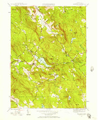
1946 Map of Monterey
USGS Topo · Published 1957About this map
Tyringham Valley serves as a central corridor for this 1946 survey, where the Appalachian Trail winds through the high ground of the Berkshire Hills. The landscape is defined by its numerous small basins and glacial remnants, including Lake Garfield near the village of Monterey and the sequestered Shaker Pond to the north. These uplands were home to diverse communities and institutions, ranging from the settlement at Hephzibah Heights to the New England Keswick Ch and Gould Farm.
Find a feature on this map
70 named features on this map. Tap any name to fly to it.
Don’t see what you’re looking for? This feature index may not catch every label — zoom into the map to look around manually.
Map Details
Editions of this 1946 Monterey Map
This is the sole edition of this map. No revisions or reprints were ever made.
Other maps of this area

1885 · Sheffield
USGS Topo · 1:62,500

1886 · Becket
USGS Topo · 1:62,500

1888 · Sheffield
USGS Topo · 1:62,500

1888 · Becket
USGS Topo · 1:62,500

1888 · Sandisfield
USGS Topo · 1:62,500

1888 · Pittsfield
USGS Topo · 1:62,500

1890 · Pittsfield
USGS Topo · 1:62,500

1891 · Sheffield
USGS Topo · 1:62,500

1893 · Becket
USGS Topo · 1:62,500

1893 · Sheffield
USGS Topo · 1:62,500