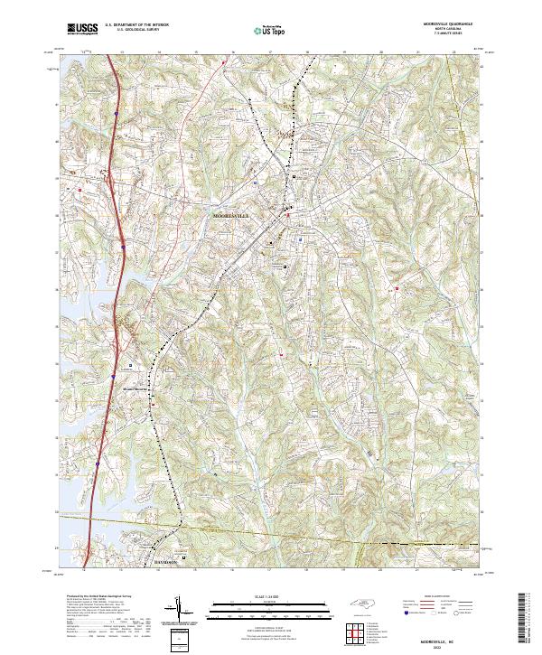
2022 Map of Mooresville
USGS Topo · Published 2022About this map
The town of Mooresville serves as the focal point of this corridor through Iredell County, illustrating the modern intersection of residential expansion and the historic Norfolk Southern rail line. To the south, the settlement of Mount Mourne and the northern edge of Davidson anchor the map, with the latter featuring the Davidson College Cem and the Christian Aid Society Cem, providing significant touchstones for local genealogical research. The landscape is defined by the headwaters of Lake Norman tributaries, including Davidson Creek and Reeds Creek, which carve through the undulating terrain.
Find a feature on this map
283 named features on this map. Tap any name to fly to it.
Don’t see what you’re looking for? This feature index may not catch every label — zoom into the map to look around manually.
Map Details
Editions of this 2022 Mooresville Map
This is the sole edition of this map. No revisions or reprints were ever made.
Other maps of this area

1893 · Statesville
USGS Topo · 1:125,000

1941 · Charlotte
USGS Topo · 1:125,000

1942 · Charlotte
USGS Topo · 1:125,000

1949 · Kannapolis
USGS Topo · 1:24,000

1949 · Hicks Crossroads
USGS Topo · 1:24,000

1953 · Charlotte
USGS Topo · 1:250,000

1954 · Charlotte
USGS Topo · 1:250,000

1960 · Charlotte
USGS Topo · 1:250,000

1962 · Charlotte
USGS Topo · 1:250,000

1969 · Shepherds
USGS Topo · 1:24,000