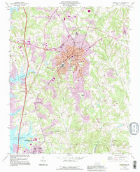
1993 Map of Mooresville
USGS Topo · Published 1996About this map
Mooresville serves as the focal point of this 1993 revision, showcasing the town's expansion along the Iredell and Mecklenburg County lines. The landscape is defined by the eastern fingers of Lake Norman, including Byers Creek and Reeds Creek, which contrast with the dense residential and industrial grid of the town center. Local heritage is deeply rooted in institutions like Davidson College and the Lowrance Hospital Center, alongside numerous community landmarks such as the Dunbar Sch and Parkview Sch.
Find a feature on this map
61 named features on this map. Tap any name to fly to it.
Don’t see what you’re looking for? This feature index may not catch every label — zoom into the map to look around manually.
Map Details
Editions of this 1993 Mooresville Map
This is the sole edition of this map. No revisions or reprints were ever made.
Other maps of this area

1893 · Statesville
USGS Topo · 1:125,000

1941 · Charlotte
USGS Topo · 1:125,000

1942 · Charlotte
USGS Topo · 1:125,000

1949 · Kannapolis
USGS Topo · 1:24,000

1949 · Hicks Crossroads
USGS Topo · 1:24,000

1953 · Charlotte
USGS Topo · 1:250,000

1954 · Charlotte
USGS Topo · 1:250,000

1960 · Charlotte
USGS Topo · 1:250,000

1962 · Charlotte
USGS Topo · 1:250,000

1969 · Shepherds
USGS Topo · 1:24,000