2023 Map of Moquino
USGS Topo · Published 2023About this map
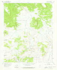
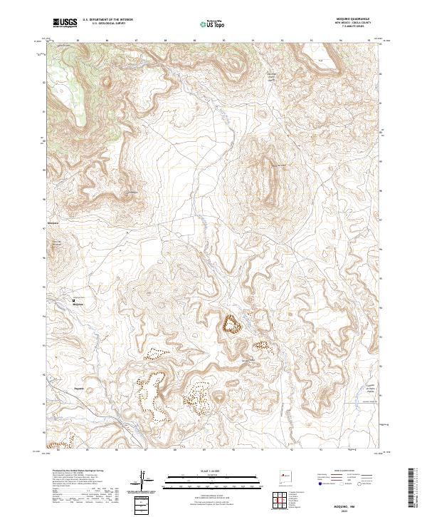
Moquino and Seboyeta anchor this high-desert landscape, where human settlement aligns with the drainage patterns of the Arroyo del Valle and Rio Moquino. In the southern portion of the map, the community of Paguate sits near the banks of the Rio Paguate, illustrating the traditional reliance on water sources in this arid region of Cibola County. The map reveals a complex topography defined by volcanic and sedimentary landforms, including the prominent Mesa del Lobo and the dark peak of Cerro Negro.
Find a feature on this map
27 named features on this map. Tap any name to fly to it.
Don’t see what you’re looking for? This feature index may not catch every label — zoom into the map to look around manually.
Map Details
Editions of this 2023 Moquino Map
This is the sole edition of this map. No revisions or reprints were ever made.