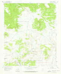
1957 Map of Moquino
USGS Topo · Published 1976About this map
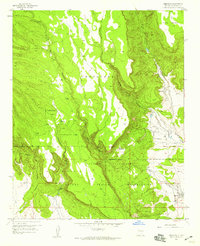
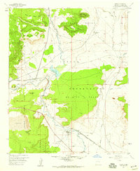
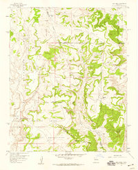
Industrial and ancient landscapes converge on this 1950s survey of the New Mexico interior, where the Laguna Indian Reservation meets the historic bounds of the Cebolleta Grant. The terrain is defined by dramatic mesas and volcanic features like Mesa Chivato and Cerro Negro, but the southern portion of the sheet reveals the massive footprints of the mid-century uranium boom. The presence of the Jackpile Mine, St Anthony Mine, and large areas of Tailings south of the Paguate Purchase Grant boundary illustrate the intense resource extraction that reshaped the region.
Find a feature on this map
27 named features on this map. Tap any name to fly to it.
Don’t see what you’re looking for? This feature index may not catch every label — zoom into the map to look around manually.
Map Details
Editions of this 1957 Moquino Map
2 editions found
Other maps of this area

1883 · Mt. Taylor
USGS Topo · 1:250,000

1886 · Mt. Taylor
USGS Topo · 1:250,000

1892 · Mt. Taylor
USGS Topo · 1:250,000

1899 · Mt. Taylor
USGS Topo · 1:250,000
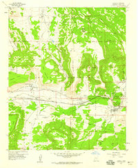
1957 · Laguna
USGS Topo · 1:24,000
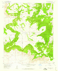
1957 · Mesa Gigante
USGS Topo · 1:24,000
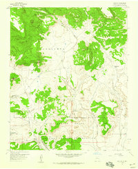
1957 · Moquino
USGS Topo · 1:24,000
1957 · Seboyeta
USGS Topo · 1:24,000
1957 · Mesita
USGS Topo · 1:24,000
1957 · Arch Mesa
USGS Topo · 1:24,000