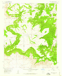
1957 Map of Mesa Gigante
USGS Topo · Published 1959About this map
The Mesa Gigante (Bell Rock Mesa) dominates the central landscape of this 1950s survey, marking a complex boundary system where the Laguna Indian Reservation meets the Canoncito Navajo Indian Reservation and the Paguate Purchase Grant. The map records a sparsely populated but historically significant convergence of land grants and tribal lands. Essential water sources and landmarks define the utility of this arid terrain, including Alamos Spring and the Harrington Windmill. Early mid-century infrastructure is visible through the placement of an Airway Beacon and a prominent Telephone Line traversing the southern portion. High points like Hawks Lookout, Chimney Rock, and Bell Rock provide clear orientation amidst the deep drainage of Cañada de los Alamos and the winding Arroyo Miranda.
Find a feature on this map
24 named features on this map. Tap any name to fly to it.
Don’t see what you’re looking for? This feature index may not catch every label — zoom into the map to look around manually.
Map Details
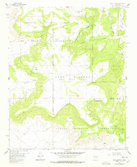
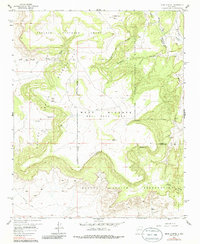
Editions of this 1957 Mesa Gigante Map
3 editions found
Other maps of this area

1883 · Mt. Taylor
USGS Topo · 1:250,000

1886 · Mt. Taylor
USGS Topo · 1:250,000

1892 · Mt. Taylor
USGS Topo · 1:250,000

1899 · Mt. Taylor
USGS Topo · 1:250,000

1917 · Cerro Verde
USGS Topo · 1:125,000

1954 · Herrera
USGS Topo · 1:24,000

1954 · South Garcia
USGS Topo · 1:24,000

1954 · Canoncito School
USGS Topo · 1:24,000

1954 · Socorro
USGS Topo · 1:250,000

1956 · South Garcia
USGS Topo · 1:62,500