1957 Map of Seboyeta
USGS Topo · Published 1959About this map
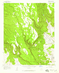
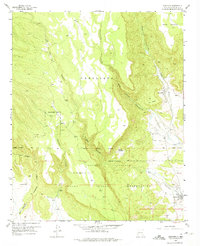
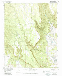
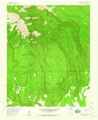
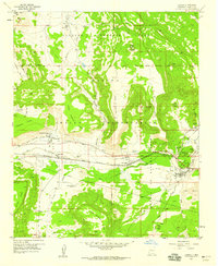
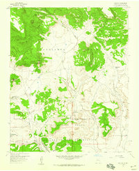
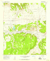
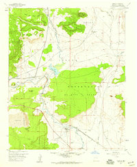
The Laguna Indian Reservation and the Paguate Purchase meet in this 1957 study of a complex landscape defined by high mesas and deep drainages. The settlement of Seboyeta sits at the base of Seboyeta Canyon, where Seboyeta Creek emerges from the steep terrain of La Mesa. This area is marked by significant land tenure boundaries, including the Grant Boundary and various reservation lines that separate ancestral lands from high plateau features like Mesa Chivato. Further south, the community of Paguate is positioned along the Rio Paguate, while Bibo serves as a small hub nearby, complete with a local Cemetery. The terrain is characterized by winding watercourses like Encinal Creek and Seboyetita Creek, which have carved deep paths through the Cebolleta region, creating a network of canyons that dictated the placement of early ranching outposts such as Rancho Chupadero.
Find a feature on this map
21 named features on this map. Tap any name to fly to it.
Don’t see what you’re looking for? This feature index may not catch every label — zoom into the map to look around manually.
Map Details
Editions of this 1957 Seboyeta Map
3 editions found
Other maps of this area

1883 · Mt. Taylor
USGS Topo · 1:250,000

1886 · Mt. Taylor
USGS Topo · 1:250,000

1892 · Mt. Taylor
USGS Topo · 1:250,000

1899 · Mt. Taylor
USGS Topo · 1:250,000
1957 · Mount Taylor
USGS Topo · 1:24,000
1957 · Laguna
USGS Topo · 1:24,000
1957 · Moquino
USGS Topo · 1:24,000
1957 · Cubero
USGS Topo · 1:24,000
1957 · Mesita
USGS Topo · 1:24,000

1958 · Albuquerque
USGS Topo · 1:250,000