1957 Map of Seboyeta
USGS Topo · Published 1974About this map
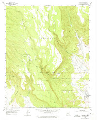
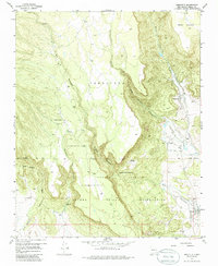
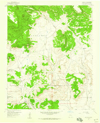
Laguna Indian Reservation lands dominate this mid-century landscape, where traditional settlements and agricultural boundaries reflect generations of habitation. The village of Seboyeta sits at the foot of Seboyeta Canyon, connected to the neighboring hamlet of Bibo along the banks of Seboyeta Creek. Further south, the settlement of Paguate is established near the Rio Paguate, marking a distinct pocket of activity within the wider Paguate Purchase area.
Find a feature on this map
20 named features on this map. Tap any name to fly to it.
Don’t see what you’re looking for? This feature index may not catch every label — zoom into the map to look around manually.
Map Details
Editions of this 1957 Seboyeta Map
3 editions found
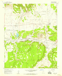
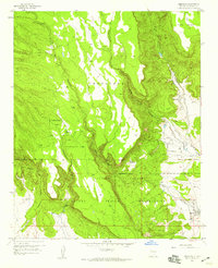
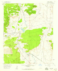
Other maps of this area

1883 · Mt. Taylor
USGS Topo · 1:250,000

1886 · Mt. Taylor
USGS Topo · 1:250,000

1892 · Mt. Taylor
USGS Topo · 1:250,000

1899 · Mt. Taylor
USGS Topo · 1:250,000
1957 · Mount Taylor
USGS Topo · 1:24,000
1957 · Laguna
USGS Topo · 1:24,000
1957 · Moquino
USGS Topo · 1:24,000
1957 · Cubero
USGS Topo · 1:24,000
1957 · Seboyeta
USGS Topo · 1:24,000
1957 · Mesita
USGS Topo · 1:24,000