2021 Map of Morehouse
USGS Topo · Published 2021About this map
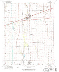
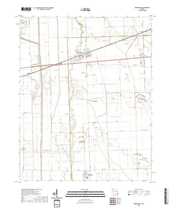
Morehouse serves as the central hub of this survey, situated at the junction of several regional routes where the flat agricultural lands of New Madrid County meet those of Scott and Stoddard. The landscape is defined by an extensive drainage network, including the Little River, Otter Slough Ditch, and the Upper Castor River, which manage the low-lying terrain of the Bootheel. Small settlements like Canalou, Delmo, and Buffington are connected by a grid of county roads such as Co Rd 799 and Co Rd 480, illustrating the persistent rural settlement patterns of the 21st century. Natural features like King Lake, Whitten Lake, and the slightly elevated Clines Island provide topographical contrast to the surrounding fields, offering specific points of interest for those studying the environmental history and land-use evolution of southeastern Missouri.
Find a feature on this map
60 named features on this map. Tap any name to fly to it.
Don’t see what you’re looking for? This feature index may not catch every label — zoom into the map to look around manually.
Map Details
Editions of this 2021 Morehouse Map
This is the sole edition of this map. No revisions or reprints were ever made.