2022 Map of Morgan
USGS Topo · Published 2022About this map
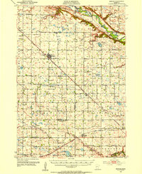
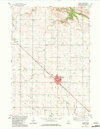
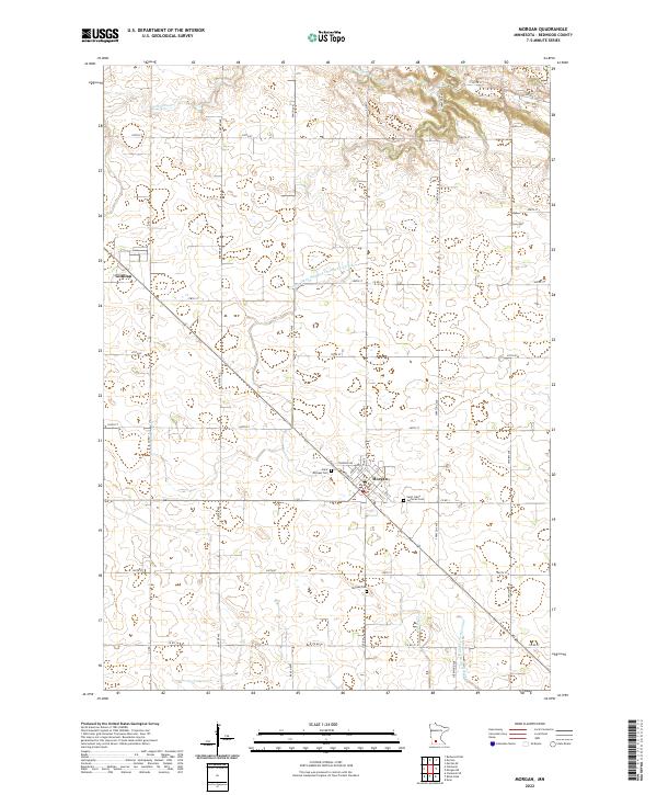
Morgan serves as the primary hub of this Redwood County landscape, where the local street grid is defined by Front St, Fergus Ave, and Carleton Ave. The surrounding rural sections are meticulously divided by a network of agricultural drainage infrastructure, including the County Ditch Number One Hundred Nine and Judicial Ditch Number Twentynine. These systems, along with natural waterways like Wabasha Cr and Spring Cr, illustrate the intensive water management required for this region's productive prairie-style farming. For genealogists, the map preserves the locations of vital community landmarks such as Saint Michael Cem, Saint Johns Lutheran Cem, and the larger Morgan Cem located south of the main settlement. Further northwest, the smaller locality of Gilfillan sits along the road and rail corridors, marking another point of historical interest in this quintessential Minnesota agricultural township.
Find a feature on this map
40 named features on this map. Tap any name to fly to it.
Don’t see what you’re looking for? This feature index may not catch every label — zoom into the map to look around manually.
Map Details
Editions of this 2022 Morgan Map
This is the sole edition of this map. No revisions or reprints were ever made.