2023 Map of Moroni
USGS Topo · Published 2023About this map
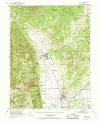
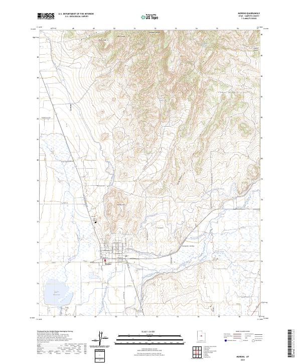
The settlement of Moroni sits at the heart of the Sanpete Valley, where a complex network of irrigation infrastructure defines the landscape. Early 21st-century water management is visible through features like the Moroni and Mount Pleasant Canal, The Canal Ditch, and Rock Dam Canal, all of which divert water across the valley floor to support local agriculture. The San Pitch River and Silver Creek meander through the lowlands, which are flanked by the rising elevations of the Wasatch Range and the Cedar Hills.
Find a feature on this map
46 named features on this map. Tap any name to fly to it.
Don’t see what you’re looking for? This feature index may not catch every label — zoom into the map to look around manually.
Map Details
Editions of this 2023 Moroni Map
This is the sole edition of this map. No revisions or reprints were ever made.