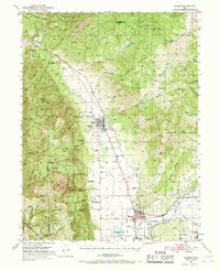
1951 Map of Moroni
USGS Topo · Published 1968About this map
Agricultural settlements of the Sanpete Valley define this mid-century landscape, centered on the grid of Moroni and the smaller community of Fountain Green further north. The map illustrates a developed irrigation system supporting local farms, with water management evidenced by the Wales Reservoir and various flumes and ditches tapping into the San Pitch River. Between the valley floor and the high ridgelines of the Wasatch Range, smaller hamlets like Freedom and Jerusalem sit at the foot of the mountains.
Find a feature on this map
84 named features on this map. Tap any name to fly to it.
Don’t see what you’re looking for? This feature index may not catch every label — zoom into the map to look around manually.
Map Details
Editions of this 1951 Moroni Map
2 editions found
Other maps of this area

1885 · Manti
USGS Topo · 1:250,000

1895 · Manti
USGS Topo · 1:250,000

1951 · Moroni
USGS Topo · 1:62,500

1951 · Santaquin
USGS Topo · 1:62,500

1951 · Nephi
USGS Topo · 1:62,500

1952 · Santaquin Peak
USGS Topo · 1:62,500

1956 · Price
USGS Topo · 1:250,000

1960 · Price
USGS Topo · 1:250,000

1962 · Price
USGS Topo · 1:250,000

1965 · Chriss Canyon
USGS Topo · 1:24,000