
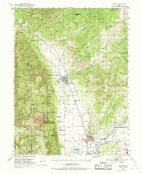
1951 Map of Moroni
USGS Topo · Published 1953About this map
Agricultural settlements of the Sanpete Valley characterize this mid-century survey, where the San Pitch River and a network of irrigation works like the Moroni Canal and Rock Dam Canal sustain the high-desert landscape. The grid patterns of Moroni and Fountain Green stand as principal hubs, connected by the rail-straight path of the local highway through the valley floor. To the west, the terrain rises sharply into the Wasatch Range, part of the Uinta National Forest, where landmarks such as Tidds Ridge and Bradley Canyon overlook the smaller settlements of Freedom and Jerusalem. Local infrastructure of the era is remarkably detailed, including the Fish Hatchery near Fountain Green, the Moroni Ranger Sta, and several local Cemeteries. High-altitude routes like Skyline Drive trace the ridge lines, providing a perspective of the complex drainage systems that feed into Wales Reservoir.
Find a feature on this map
79 named features on this map. Tap any name to fly to it.
Don’t see what you’re looking for? This feature index may not catch every label — zoom into the map to look around manually.
Map Details
Editions of this 1951 Moroni Map
2 editions found
Other maps of this area

1885 · Manti
USGS Topo · 1:250,000

1895 · Manti
USGS Topo · 1:250,000

1951 · Santaquin
USGS Topo · 1:62,500

1951 · Nephi
USGS Topo · 1:62,500

1952 · Santaquin Peak
USGS Topo · 1:62,500

1956 · Price
USGS Topo · 1:250,000

1960 · Price
USGS Topo · 1:250,000

1962 · Price
USGS Topo · 1:250,000

1965 · Chriss Canyon
USGS Topo · 1:24,000

1965 · Wales
USGS Topo · 1:24,000