
1965 Map of Wales
USGS Topo · Published 1967About this map
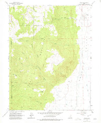
The settlement of Wales sits at the foot of the high country, where the floor of the Sanpete Valley meets the steep eastern slopes of the San Pitch Mountains. This 1960s survey documents a landscape defined by the transition from irrigated valley agriculture along the San Pitch River to the timbered reaches of the Uinta National Forest. The topography is etched by numerous drainage systems such as Wales Canyon, Petes Canyon, and Coal Canyon, which reveal the historical reliance on these natural corridors for movement and resources. High-elevation landmarks like Pitch Mountain and Horse Mountain dominate the western half of the sheet, while the presence of a Mine and several gravel pits near the valley floor points to the area's local extractive industry. A network of primitive routes, including a Jeep Trail near Water Hollow, provides access into the rugged canyons, illustrating how the community interacted with the daunting terrain of the Juab and Sanpete county border.
Find a feature on this map
32 named features on this map. Tap any name to fly to it.
Don’t see what you’re looking for? This feature index may not catch every label — zoom into the map to look around manually.
Map Details
Editions of this 1965 Wales Map
2 editions found
Other maps of this area

1885 · Manti
USGS Topo · 1:250,000

1895 · Manti
USGS Topo · 1:250,000

1951 · Moroni
USGS Topo · 1:62,500

1951 · Nephi
USGS Topo · 1:62,500

1956 · Price
USGS Topo · 1:250,000

1960 · Price
USGS Topo · 1:250,000

1962 · Price
USGS Topo · 1:250,000

1965 · Chriss Canyon
USGS Topo · 1:24,000

1965 · Hells Kitchen Canyon SE
USGS Topo · 1:24,000

1965 · Manti
USGS Topo · 1:24,000