
1965 Map of Manti
USGS Topo · Published 1967About this map
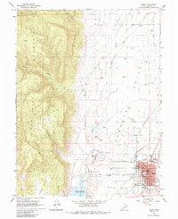
Manti serves as the focal point of this mid-1960s survey, situated where the Sanpete Valley meets the rising San Pitch Mountains. The town's layout is meticulously detailed, showing the Manti Temple and the County Fairgrounds, alongside essential civic structures like the High School, Courthouse, and Manti Cemetery. The landscape transitions from the residential and agricultural grid of the valley floor to the steep drainages of Maple Canyon and Dodge Canyon.
Find a feature on this map
34 named features on this map. Tap any name to fly to it.
Don’t see what you’re looking for? This feature index may not catch every label — zoom into the map to look around manually.
Map Details
Editions of this 1965 Manti Map
2 editions found
Other maps of this area

1885 · Manti
USGS Topo · 1:250,000

1895 · Manti
USGS Topo · 1:250,000

1956 · Price
USGS Topo · 1:250,000

1960 · Price
USGS Topo · 1:250,000

1962 · Price
USGS Topo · 1:250,000

1965 · Chriss Canyon
USGS Topo · 1:24,000

1965 · Hells Kitchen Canyon SE
USGS Topo · 1:24,000

1965 · Wales
USGS Topo · 1:24,000

1965 · Black Mountain
USGS Topo · 1:24,000

1966 · Chester
USGS Topo · 1:24,000