
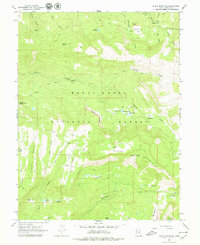
1965 Map of Black Mountain
USGS Topo · Published 1968About this map
Manti La Sal National Forest dominates this mid-1960s landscape, where high-altitude plateaus and deep canyons define the Utah wilderness. The map documents a rugged interior managed for both natural preservation and seasonal use, evidenced by the presence of the Mt Baldy Guard Station and the Grove of the Aspen Giants Scenic Area. Water management is central to the area's utility, with several catchments like Patton Reservoir, Newfield Reservoir, and the Town Reservoir providing critical resources in the high country.
Find a feature on this map
46 named features on this map. Tap any name to fly to it.
Don’t see what you’re looking for? This feature index may not catch every label — zoom into the map to look around manually.
Map Details
Editions of this 1965 Black Mountain Map
2 editions found
Other maps of this area

1885 · Manti
USGS Topo · 1:250,000

1895 · Manti
USGS Topo · 1:250,000

1922 · Wasatch
USGS Topo · 1:31,680

1956 · Price
USGS Topo · 1:250,000

1960 · Price
USGS Topo · 1:250,000

1962 · Price
USGS Topo · 1:250,000
1965 · Woods Lake
USGS Topo · 1:24,000
1965 · Mayfield
USGS Topo · 1:24,000

1965 · Manti
USGS Topo · 1:24,000
1966 · Ferron Reservoir
USGS Topo · 1:24,000