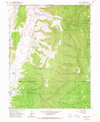
1965 Map of Mayfield
USGS Topo · Published 1967About this map
Arapien Valley and the settlement of Mayfield occupy the heart of this mid-1960s survey, illustrating a landscape shaped by water management and high-country transitions. The town sits at the mouth of Twelvemile Creek, where the South Canal diverts water for agricultural use before the terrain rises sharply into the Manti-La Sal National Forest. A notable historical detail is the Old Indian Treaty Boundary that cuts east-west across the southern portion of the map, marking an earlier era of land division.
Find a feature on this map
29 named features on this map. Tap any name to fly to it.
Don’t see what you’re looking for? This feature index may not catch every label — zoom into the map to look around manually.
Map Details
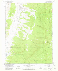
Editions of this 1965 Mayfield Map
2 editions found
Other maps of this area

1885 · Manti
USGS Topo · 1:250,000

1885 · Fish Lake
USGS Topo · 1:250,000

1895 · Manti
USGS Topo · 1:250,000

1896 · Fish Lake
USGS Topo · 1:250,000

1956 · Salina
USGS Topo · 1:250,000

1956 · Price
USGS Topo · 1:250,000

1960 · Price
USGS Topo · 1:250,000

1960 · Salina
USGS Topo · 1:250,000

1962 · Salina
USGS Topo · 1:250,000

1962 · Price
USGS Topo · 1:250,000