
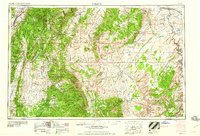
1960 Map of Salina
USGS Topo · Published 1960About this map
Salina and the rural communities of the Sevier and Fremont River valleys anchor this 1960 study of south-central Utah. The map reveals a transition from the agricultural high plateaus in the west—including the Wasatch Plateau and Fish Lake Plateau—to the stark, eroded geology of the east. This period captures the early footprint of Capitol Reef National Monument near Fruita, long before its expansion into a national park. The rugged interior is defined by massive topographic features like the San Rafael Swell and the Waterpocket Fold, while industrial interest is noted by uranium sites in the desert. Transportation corridors are dominated by the Denver and Rio Grande Western RR and early alignments of Utah 24, connecting remote settlements like Hanksville and Notom to the broader region.
Find a feature on this map
66 named features on this map. Tap any name to fly to it.
Don’t see what you’re looking for? This feature index may not catch every label — zoom into the map to look around manually.
Map Details
Editions of this 1960 Salina Map
2 editions found
Other maps of this area

1885 · San Rafael
USGS Topo · 1:250,000

1885 · Manti
USGS Topo · 1:250,000

1885 · East Tavaputs
USGS Topo · 1:250,000

1885 · La Sal
USGS Topo · 1:250,000

1885 · Beaver
USGS Topo · 1:250,000

1885 · Sevier Desert
USGS Topo · 1:250,000

1885 · Fish Lake
USGS Topo · 1:250,000

1886 · Kanab
USGS Topo · 1:250,000

1886 · Escalante
USGS Topo · 1:250,000

1886 · Henry Mountains
USGS Topo · 1:250,000