Old Maps of Sevier County, Utah
Explore 335 old maps of Sevier County, spanning from 1885 to today. These high-resolution historic maps reveal how streets, neighborhoods, landmarks, and natural features evolved over time — perfect for genealogy, metal detecting, research, and local history exploration.
What you can do with these maps:
- See how Sevier County changed over time: Compare historical maps to modern-day views to trace roads, homesites, rail lines & more.
- View detailed metadata: Each map includes creators, publishers, year, scale, and archive source.
- Overlay maps with satellite & LiDAR: Visualize the past alongside modern tools to explore terrain & human change.
- Trusted historical sources: Maps sourced from the USGS, Library of Congress, and other archives.
- Access maps your way: View online, download high-res files, or order prints for personal or research use.
Start exploring old maps of Sevier County to uncover forgotten places, hidden landmarks, and the deep history beneath your feet.
Sevier County, UT maps
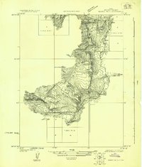
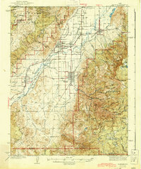
(335)- 1885 Map of Manti
 1885 Manti1885 Print · USGSCentral Utah during the mid-1880s reveals a growing network of agricultural towns and vital rail lines through the high desert. Researchers can trace early family settlements along the San Pete River and locate historic depots like Pleasant Valley Junction or the early township of Nephi.4 unique versions available
 - 1885 Map of Beaver
 1885 Beaver1885 Print · USGSSouth-central Utah in the 1880s was a landscape of high plateaus and valley settlements tied to the lifelines of the Sevier River and Beaver Creek. Family researchers can trace early town layouts in Beaver and Fillmore or locate rural outposts like Minersville and Kanosh.5 unique versions available
 - 1885 Map of Sevier Desert
 1885 Sevier Desert1885 Print · USGSMining districts and desert outposts across central Utah come to life in the mid-1880s as the railroad pushes through the canyon. Researchers can trace early industrial footprints at Silver City, locate the riverside settlement of Deseret, and follow the original Central Pacific Railroad line.5 unique versions available
 - 1885 Map of Fish Lake
 1885 Fish Lake1885 Print · USGSThe high plateaus and early canyon settlements of central Utah are documented here in the mid-1880s, shortly after the Powell Survey. Genealogists and historians can trace early families in Salina, Antimony, and Cousharem, or locate remote sites like Bean Spring.
 - 1895 Map of Manti, 1921 Print
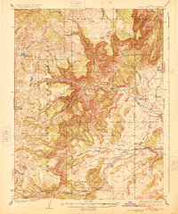
 1895 Manti1921 Print · USGSSanpete County and the high plateaus of central Utah are captured in the late nineteenth century as irrigation and railroads transformed the valley floor. Genealogists and historians can trace the early layout of Manti, Ephraim, and Nephi, alongside smaller outposts like Fountain Green and Mayfield.
 - 1896 Map of Fish Lake, 1899 Print
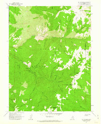
 1896 Fish Lake1899 Print · USGSSouthern Utah in the late nineteenth century is a land of high plateaus and isolated river settlements. Trace early pioneer outposts like Thurber, Teardale, and Antimony alongside geological marvels such as Fish Lake and the Water Pocket Flexure.4 unique versions available
 - 1922 Map of Emery No.3
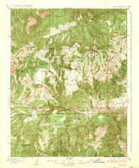
 1922 Emery No.31922 Print · USGSHigh mountain peaks and canyon drainage systems define this Sevier County landscape during the early 1920s. Researchers can trace the early path of a primitive Road winding through the canyon alongside Clear Creek near Johns Peak.
 - 1922 Map of Wasatch
 1922 Wasatch1922 Print · USGSThe high-elevation grazing lands of Sanpete and Emery County are captured in the early 1920s as a landscape of isolated ridges and ranch outposts. Genealogists and historians can trace family-named landmarks like Larsen Ranch and Hansen Ranch near Lower Joes Valley.
 - 1925 Map of Acord Lakes
 1925 Acord Lakes1925 Print · USGSThe high plateau and canyon country of Sevier and Emery Counties are captured here in the mid-1920s as ranching and early mining defined the local economy. Researchers can locate remote family landmarks like Peacocks Place, the Browning Mine, and the historic Quitchupah Ranch.3 unique versions available
 - 1932 Map of Sevier, 1975 Print
 1932 Sevier1975 Print · USGSThe high plateau country of central Utah comes into focus in the early 1930s, showing a landscape defined by the Denver & Rio Grande Western railroad and remote mountain peaks. Genealogists and local historians can trace family-named landmarks like Parker Ranch or locate early forest service outposts at Rockwood Ranger Sta.
 - 1935 Map of Sevier
 1935 Sevier1935 Print · USGSThe high country of Sevier and Millard Counties is captured here in the mid-1930s, documenting the early forest management and transit routes of the era. Genealogists and historians can trace old homesteads like Parker Ranch and find remote outposts such as Rockwood Ranger Sta and Pavant Ranger Sta.3 unique versions available
 - 1940 Map of Monroe, 1957 Print
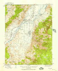 1940 Monroe1957 Print · USGSThe Sevier River valley was a thriving corridor of rail and irrigation just before the mid-century. Researchers can trace the path of the Denver and Rio Grande Western Railroad through Monroe or locate the Antelope Mine and Poverty Flat Ranch.2 unique versions available
 - 1944 Map of Monroe
 1944 Monroe1944 Print · USGSThe Sevier River Valley thrived as a hub of irrigation and rail transport in the mid-twentieth century. Genealogists and historians can trace the foundations of Monroe, Elsinore, and Annabella alongside the ANTELOPE MINE and Poverty Flat Ranch.
 - 1953 Map of Richfield, 1963 Print
 1953 Richfield1963 Print · USGSCentral Utah in the early fifties reveals a complex geography of high plateaus and desert basins tied together by the Union Pacific rail lines. Genealogists and historians can trace family roots in Richfield or Kanosh and locate remote operations like the Blue Star Mine or Newhouse.3 unique versions available
 - 1953 Map of Delta, 1969 Print
 1953 Delta1969 Print · USGSWest-central Utah in the early fifties shows a landscape of vast desert playas and rising mountain ranges. Genealogists and historians can trace rail sidings like Champlin Siding, local industry at the Tungsten Mill, and historic outposts such as Fort Deseret.3 unique versions available
 - 1956 Map of Salina
 1956 Salina1956 Print · USGSCentral Utah in the mid-fifties reveals a landscape of high plateaus and desert basins before the modern highway era. Researchers can trace the ranching and mining roots of Hanksville and Loa or locate the Lucky Strike Mine near the San Rafael Swell.5 unique versions available
 - 1956 Map of Price, 1968 Print
 1956 Price1968 Print · USGSCentral Utah in the mid-fifties showcases a landscape shaped by coal mining and mountain-fed irrigation. Trace the rail-and-river economy through the Geneva Coal Mine, the Union Pacific line, and settlements like Price and Ephraim.3 unique versions available
 - 1958 Map of Richfield
 1958 Richfield1958 Print · USGSCentral Utah in the late fifties shows a landscape of mountain forests and desert basins connected by the Union Pacific Railroad. Genealogists and historians can trace rail stops at Nada Station, mines like the Blue Star Mine, and tribal lands of the Paiute Indian Reservation.2 unique versions available
 - 1958 Map of Delta
 1958 Delta1958 Print · USGSThe West Desert of Utah comes into sharp focus during the late 1950s, showing the intersection of military ranges, irrigation projects, and historical transit. You can trace the proximity of the Topaz Camp to Delta, or locate the Pony Express Monument and the ruins of Fort Deseret.
 - 1960 Map of Price
 1960 Price1960 Print · USGSCentral Utah in the late fifties was a landscape of coal-hauling railroads and high plateau settlements. Genealogists and local historians can trace the rail-to-river economy from Price to the mountain mining camps of Hiawatha, Dragerton, and Sunnyside.2 unique versions available
 - 1960 Map of Salina
 1960 Salina1960 Print · USGSThe high plateaus and canyonlands of south-central Utah appear in the early sixties as a region of remote ranching towns and developing parklands. Researchers can trace historic settlements like Fruita and Loa or locate the uranium mines and the tracks of the Denver and Rio Grande Western RR.2 unique versions available
 - 1961 Map of Mt. Catherine, 1963 Print
 1961 Mt. Catherine1963 Print · USGSThe Pavant Range in Millard County comes into focus in the early sixties, showing the recreational development of the forest. Researchers can locate remote forest outposts like Indian Springs Guard Station and unique landmarks such as Pistol Rock Picnic Area.2 unique versions available
 - 1961 Map of Richfield, 1963 Print
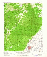 1961 Richfield1963 Print · USGSRichfield and the Sevier River valley thrive in the early sixties as a center for agriculture and local industry. Genealogists and historians can trace the irrigation network of the Vermillion Canal, identify early schools like High Sch, and locate the old path of the Denver and Rio Grande Western Railroad.
 - 1962 Map of Salina
 1962 Salina1962 Print · USGSSevier County and the surrounding desert wilderness appear here in the early sixties as a network of isolated river valley towns and high-altitude forests. Researchers can locate remote landmarks like Fruita, trace the Denver & Rio Grande Western RR, and find backcountry sites like the Aquarius Ranger Station.
 - 1962 Map of Price
 1962 Price1962 Print · USGSCentral Utah during the early sixties shows a landscape balancing high-mountain forestry with valley agriculture and coal mining. Genealogists and historians can trace the Denver and Rio Grande Western rail lines through industrial hubs like Price or locate formerly active sites like Coal City (abandoned).
Showing maps 1-25 of 335
Top cities of Sevier County
- Richfield historical maps
- Salina historical maps
- Monroe historical maps
- Aurora historical maps
- Redmond historical maps
- Elsinore historical maps
See more
Frequently asked questions
- What are the different types of historical maps available for Sevier County?
- What is the oldest map of Sevier County?
- Where can I purchase historical maps of Sevier County for my home or office?
- Where can I download high-res historical maps of Sevier County?
- Are there historical topographic maps available for Sevier County?
- Is there historical aerial imagery available for Sevier County?
- Where are historical maps of Sevier County sourced from?