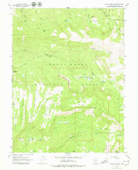
1965 Map of Black Mountain
USGS Topo · Published 1979About this map
Manti La Sal National Forest encompasses the high mountain ridges and deep canyons of this mid-1960s survey, revealing a landscape defined by seasonal ranching and high-altitude water management. The terrain is marked by family and localized names such as Bub Arthurs Flat, Metcalf Spring, and Lower Ranch, indicating the area's long-standing use for summer grazing. A network of primitive ways, including the Harmon Trail and numerous jeep tracks, connects remote outposts like the Mt Baldy Guard Station to vital water sources such as Patton Reservoir and Newfield Reservoir. These features, alongside the Grove of the Aspen Giants Scenic Area, highlight the era's focus on forest management and conservation before the modernization of mountain access. Geologists and local historians can trace the intricate drainage of Twelvemile Creek and the North Fork as they carve through the high plateaus.
Find a feature on this map
56 named features on this map. Tap any name to fly to it.
Don’t see what you’re looking for? This feature index may not catch every label — zoom into the map to look around manually.
Map Details
Editions of this 1965 Black Mountain Map
2 editions found
Other maps of this area

1885 · Manti
USGS Topo · 1:250,000

1895 · Manti
USGS Topo · 1:250,000

1922 · Wasatch
USGS Topo · 1:31,680

1956 · Price
USGS Topo · 1:250,000

1960 · Price
USGS Topo · 1:250,000

1962 · Price
USGS Topo · 1:250,000
1965 · Woods Lake
USGS Topo · 1:24,000
1965 · Mayfield
USGS Topo · 1:24,000

1965 · Manti
USGS Topo · 1:24,000

1965 · Black Mountain
USGS Topo · 1:24,000