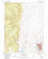
1965 Map of Manti
USGS Topo · Published 1985About this map
The Manti Temple stands as a prominent landmark on this 1960s survey of the Sanpete Valley, overlooking a landscape defined by Mormon settlement patterns and irrigation engineering. The city of Manti is mapped in detail, showing civic infrastructure such as the Courthouse, Po, and the County Fairgrounds. The town's grid is bounded by City Creek and South Creek, with several Quarries located just outside the residential core.
Find a feature on this map
34 named features on this map. Tap any name to fly to it.
Don’t see what you’re looking for? This feature index may not catch every label — zoom into the map to look around manually.
Map Details
Editions of this 1965 Manti Map
2 editions found
Other maps of this area

1885 · Manti
USGS Topo · 1:250,000

1895 · Manti
USGS Topo · 1:250,000

1956 · Price
USGS Topo · 1:250,000

1960 · Price
USGS Topo · 1:250,000

1962 · Price
USGS Topo · 1:250,000

1965 · Chriss Canyon
USGS Topo · 1:24,000

1965 · Hells Kitchen Canyon SE
USGS Topo · 1:24,000

1965 · Manti
USGS Topo · 1:24,000

1965 · Wales
USGS Topo · 1:24,000

1965 · Black Mountain
USGS Topo · 1:24,000