
1951 Map of Nephi
USGS Topo · Published 1953About this map
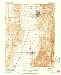
Nephi serves as the primary hub of this Juab County landscape, positioned where the Union Pacific railroad and major highways meet at the foot of the Mountains. The survey illustrates an integrated agricultural and industrial environment, featuring the Utah Agriculture Experiment Station and the County Fairgrounds alongside specialized works like the Gypsum Mill and Nephi Power Plant. To the south, the smaller grid of Levan is nestled against Levan Ridge, while the settlement of Juab sits further down the rail line.
Find a feature on this map
75 named features on this map. Tap any name to fly to it.
Don’t see what you’re looking for? This feature index may not catch every label — zoom into the map to look around manually.
Map Details
Editions of this 1951 Nephi Map
4 editions found
Other maps of this area

1885 · Manti
USGS Topo · 1:250,000

1885 · Sevier Desert
USGS Topo · 1:250,000

1895 · Manti
USGS Topo · 1:250,000

1951 · Moroni
USGS Topo · 1:62,500

1951 · Santaquin
USGS Topo · 1:62,500

1952 · Scipio North
USGS Topo · 1:62,500

1952 · Santaquin Peak
USGS Topo · 1:62,500

1953 · Delta
USGS Topo · 1:250,000

1954 · Tintic Mountain
USGS Topo · 1:24,000

1956 · Price
USGS Topo · 1:250,000