
1953 Map of Delta
USGS Topo · Published 1969About this map
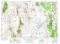
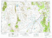
The Sevier Lake basin and the surrounding West Desert landscape define this 1950s survey, showing a region shaped by both its arid geography and industrial efforts. Settled pockets like Delta and Hinckley appear alongside the irrigation infrastructure of the Sevier River, including the Gunnison Bend Res. The map documents a diverse human footprint, from the high-altitude mining activities near Mammoth and Silver City to the military presence of the Wendover Bombing and Gunnery Range in the Great Salt Lake Desert. Historical transit and social landmarks are noted throughout, such as the Pony Express Monument and the Goshute Indian Res, as well as leisure destinations like Wilson Health Springs Resort and the Crater Springs Health Resort. The presence of the Union Pacific railroad and numerous abandoned sites, including Fort Deseret and the GCC Camp, reflect the ebb and flow of settlement in the eastern Great Basin.
Find a feature on this map
141 named features on this map. Tap any name to fly to it.
Don’t see what you’re looking for? This feature index may not catch every label — zoom into the map to look around manually.
Map Details
Editions of this 1953 Delta Map
3 editions found
Other maps of this area

1885 · Salt Lake
USGS Topo · 1:250,000

1885 · Manti
USGS Topo · 1:250,000

1885 · Beaver
USGS Topo · 1:250,000

1885 · Sevier Desert
USGS Topo · 1:250,000

1885 · Fish Lake
USGS Topo · 1:250,000

1885 · Tooele Valley
USGS Topo · 1:250,000

1895 · Manti
USGS Topo · 1:250,000

1896 · Fish Lake
USGS Topo · 1:250,000

1908 · Fish Springs
USGS Topo · 1:250,000

1910 · Fish Springs
USGS Topo · 1:250,000