Loading...
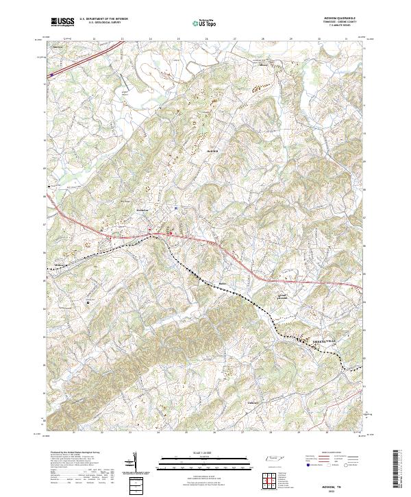
Loading map...2022 Map of Mosheim
USGS Topo · Published 2022About this map
Mosheim and the surrounding Greene County countryside are defined by the winding drainages of Lick Creek to the north and Little Chucky Creek to the south. This agrarian landscape is crisscrossed by the Norfolk Southern rail line, which links several historic communities including Midway, Rader, and Mount Pleasant. The map reveals a dense network of family-named roads and landmarks, such as Hull Mill and Tipton Spring, that speak to the region's long-settled character.
Find a feature on this map
159 named features on this map. Tap any name to fly to it.
Don’t see what you’re looking for? This feature index may not catch every label — zoom into the map to look around manually.
Map Details
Date Portrayed2022
Date Published2022
PublisherU.S. Geological Survey
Map TypeTopographic
Scale1:24000
Physical Dimensions24 x 29 inches
Editions of this 2022 Mosheim Map
This is the sole edition of this map. No revisions or reprints were ever made.
Historical Maps of Albany Through Time
Featured Locations
Source Details
SourceU.S. Geological Survey
CopyrightPublic Domain