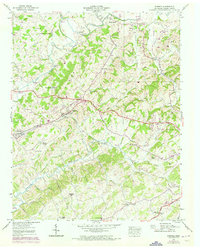
1939 Map of Mosheim
USGS Topo · Published 1973About this map
Mosheim and the surrounding Greene County countryside are defined by a complex network of waterways and early Tennessee transportation corridors. The Southern railroad runs parallel to the Andrew Johnson Highway, linking the settlements of Midway and Mosheim through a landscape dotted with country churches like Big Spring Ch and Brown Springs Ch. The map reveals a high density of rural institutions, from the Glenwood Sch in the south to Carter Chapel near the northern border, reflecting a well-established agrarian community.
Find a feature on this map
54 named features on this map. Tap any name to fly to it.
Don’t see what you’re looking for? This feature index may not catch every label — zoom into the map to look around manually.
Map Details
Editions of this 1939 Mosheim Map
3 editions found
Other maps of this area

1883 · Morristown
USGS Topo · 1:125,000

1892 · Greeneville
USGS Topo · 1:125,000

1893 · Morristown
USGS Topo · 1:125,000

1895 · Morristown
USGS Topo · 1:125,000

1896 · Greeneville
USGS Topo · 1:125,000

1904 · Greeneville
USGS Topo · 1:125,000

1935 · Surgoinsville
USGS Topo · 1:48,000

1935 · Baileyton
USGS Topo · 1:24,000

1935 · Rogersville
USGS Topo · 1:48,000

1935 · Parrottsville
USGS Topo · 1:24,000