2023 Map of Moundsville
USGS Topo · Published 2023About this map
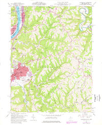
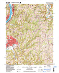
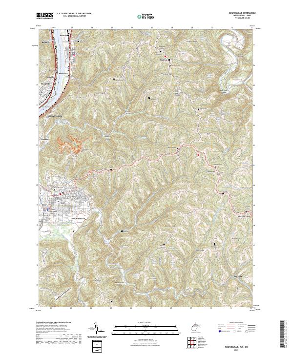
The Grave Creek Indian Mound stands as a central monument in this Ohio River valley landscape, surrounded by the developed grid of Moundsville. The river corridor, constrained by the steep topography of The Narrows, serves as the primary artery for the industrial and residential centers of McMechen, Glendale, and Benwood. Above the valley floor, the terrain transitions into a complex system of ridges and hollows, including Waymans Ridge and Blairs Ridge, where long-standing rural communities are marked by numerous family and community cemeteries like McHenry Cem and Shafer Farm Cem.
Find a feature on this map
184 named features on this map. Tap any name to fly to it.
Don’t see what you’re looking for? This feature index may not catch every label — zoom into the map to look around manually.
Map Details
Editions of this 2023 Moundsville Map
This is the sole edition of this map. No revisions or reprints were ever made.
Historical Maps of Avondale Through Time
4 maps found