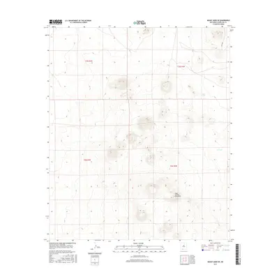
2017 Map of Mount Aden SW
USGS Topo · Published 2017About this map
The West Potrillo Mountains dominate the southeastern portion of this landscape, rising above the arid Chihuahuan Desert terrain of Doña Ana County. This high-altitude perspective of the southern New Mexico ranchlands is defined by a series of volcanic peaks and distinct depressions. Water sources are scarce, marked only by remote man-made catchments like Sally Tank and Cow Tank, which serve the livestock of the surrounding basin. This specific area is organized under the Public Land Survey System as sections within t25s r4w, t25s r3w, t26s r4w, and t26s r3w. The presence of Co Rd B001 in the northeast corner represents one of the few improved routes providing access to this isolated volcanic field, used primarily by local ranchers and those traversing the desert west of the Mesilla Valley.
Find a feature on this map
8 named features on this map. Tap any name to fly to it.
Don’t see what you’re looking for? This feature index may not catch every label — zoom into the map to look around manually.
Map Details
Editions of this 2017 Mount Aden SW Map
This is the sole edition of this map. No revisions or reprints were ever made.
Other maps of this area

1917 · Camel Mountain
USGS Topo · 1:62,500

1917 · Mt. Riley
USGS Topo · 1:62,500

1918 · Mt. Riley
USGS Topo · 1:62,500

1929 · Mt. Riley
USGS Topo · 1:62,500

1941 · Aden
USGS Topo · 1:62,500

1943 · Aden
USGS Topo · 1:62,500

1951 · Mt. Riley
USGS Topo · 1:62,500

1953 · El Paso
USGS Topo · 1:250,000

1955 · Las Cruces
USGS Topo · 1:250,000

1958 · Las Cruces
USGS Topo · 1:250,000