2023 Map of Mount Blanchard
USGS Topo · Published 2023About this map
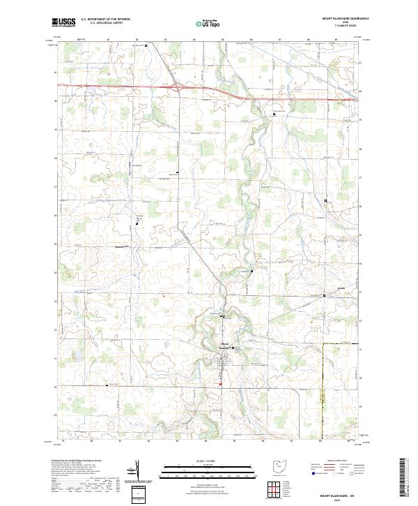
Mount Blanchard serves as the primary hub of this rural Hancock County landscape, where the Blanchard River meanders southward toward its confluence with Potato Run. The map reveals a dense network of early burial grounds and small settlements that define the region's genealogical character, including the uniquely named Frontiers Repose Cem near Houcktown and the Five Points Cem to the east. Agricultural patterns are marked by a complex system of drainage, such as Stahl Ditch and Brights Ditch, which support the surrounding farmlands. Transport history is anchored by S Main St and the modest Lutz Airport, while smaller hamlets like Pratts appear along the eastern county line, illustrating the persistent 19th-century settlement grid into the modern era.
Find a feature on this map
85 named features on this map. Tap any name to fly to it.
Don’t see what you’re looking for? This feature index may not catch every label — zoom into the map to look around manually.
Map Details
Editions of this 2023 Mount Blanchard Map
This is the sole edition of this map. No revisions or reprints were ever made.
Historical Maps of Mount Blanchard Through Time
1 maps found