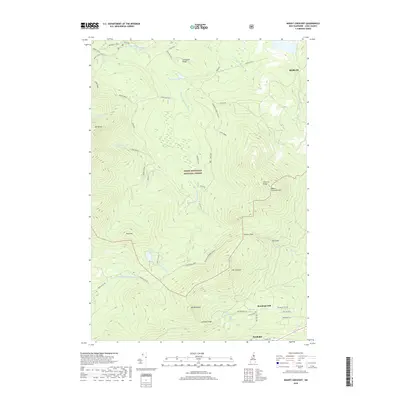
2018 Map of Mount Crescent
USGS Topo · Published 2018About this map
White Mountain National Forest dominates this landscape, where the rugged topography of the Crescent Range meets the headwaters of the Ammonoosuc River. The map focuses on the high-elevation terrain between the city of Berlin and the village of Randolph, a region defined by steep summits and narrow notches. Historic land use is evident at locations like Landing Camp and the repeated instances of Bog Dam along the Upper Ammonoosuc River. The network of footpaths, including the Vyron D Lowe Trl and Pasture Path Trl, reflects the long-standing recreational heritage of the area near Randolph Hill. Natural landmarks such as Lookout Ledge and the secluded Pond of Safety provide specific points of interest for those studying the geography of Coos County.
Find a feature on this map
51 named features on this map. Tap any name to fly to it.
Don’t see what you’re looking for? This feature index may not catch every label — zoom into the map to look around manually.
Map Details
Editions of this 2018 Mount Crescent Map
This is the sole edition of this map. No revisions or reprints were ever made.
Other maps of this area

1893 · Mt. Washington
USGS Topo · 1:62,500

1893 · Gorham
USGS Topo · 1:62,500

1896 · Mt. Washington
USGS Topo · 1:62,500

1896 · Gorham
USGS Topo · 1:62,500

1930 · Milan
USGS Topo · 1:62,500

1930 · Percy
USGS Topo · 1:62,500

1933 · Milan
USGS Topo · 1:62,500

1934 · Percy
USGS Topo · 1:62,500

1934 · Milan
USGS Topo · 1:62,500

1935 · Mt. Washington
USGS Topo · 1:62,500