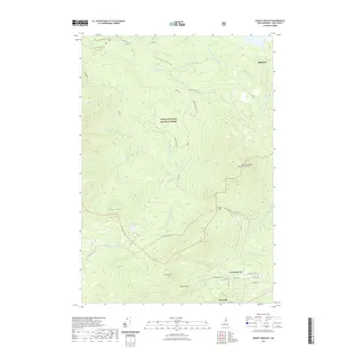
2021 Map of Mount Crescent
USGS Topo · Published 2021About this map
The White Mountain National Forest dominates this northern New Hampshire landscape, centered on the high ridges of the Crescent Range. In the southern portion of the sheet, the settlement of Randolph Hill and the town of Randolph provide a gateway to the high peaks, with local roads like Durand Rd and Randolph Hill Rd serving the community. The topography is defined by significant landmarks such as Mt Crescent, Mt Randolph, and the dramatic Ice Gulch.
Find a feature on this map
43 named features on this map. Tap any name to fly to it.
Don’t see what you’re looking for? This feature index may not catch every label — zoom into the map to look around manually.
Map Details
Editions of this 2021 Mount Crescent Map
This is the sole edition of this map. No revisions or reprints were ever made.
Other maps of this area

1893 · Mt. Washington
USGS Topo · 1:62,500

1893 · Gorham
USGS Topo · 1:62,500

1896 · Mt. Washington
USGS Topo · 1:62,500

1896 · Gorham
USGS Topo · 1:62,500

1930 · Milan
USGS Topo · 1:62,500

1930 · Percy
USGS Topo · 1:62,500

1933 · Milan
USGS Topo · 1:62,500

1934 · Percy
USGS Topo · 1:62,500

1934 · Milan
USGS Topo · 1:62,500

1935 · Mt. Washington
USGS Topo · 1:62,500