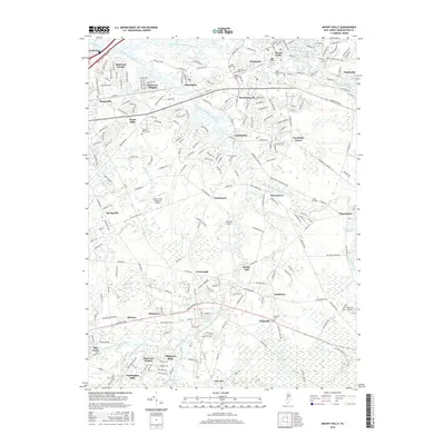
2016 Map of Mount Holly
USGS Topo · Published 2016About this map
The South Branch Rancocas Creek and its many tributaries carve a network through Burlington County, defining the location of historic milling centers and early settlements. Kirbys Mill stands as a prominent landmark of this water-driven industry, while Vincentown Millpond and Smithville Lake further illustrate the area's hydraulic history. Modern aviation hubs like the South Jersey Regional Airport and Flying W Airport occupy the flatlands between established communities. For genealogists, the map is a dense resource of local history, identifying numerous burial grounds including Saint Andrews Cem, Evergreen Cem, and Saint Marys Cem. Small clusters such as Chairville, Sandtown, and Hoot Owl Estates represent the evolving residential character of the region as it transitioned from traditional milling towns into the 21st century.
Find a feature on this map
63 named features on this map. Tap any name to fly to it.
Don’t see what you’re looking for? This feature index may not catch every label — zoom into the map to look around manually.
Map Details
Editions of this 2016 Mount Holly Map
This is the sole edition of this map. No revisions or reprints were ever made.
Other maps of this area

1888 · Bordentown
USGS Topo · 1:62,500

1888 · Pemberton
USGS Topo · 1:62,500

1888 · Mount Holly
USGS Topo · 1:62,500

1890 · Burlington
USGS Topo · 1:62,500

1893 · Bordentown
USGS Topo · 1:62,500

1893 · Burlington
USGS Topo · 1:62,500

1894 · Pemberton
USGS Topo · 1:62,500

1894 · Mount Holly
USGS Topo · 1:62,500

1898 · Pemberton
USGS Topo · 1:62,500

1898 · Mount Holly
USGS Topo · 1:62,500
Featured Places
- Mount Laurel Township, NJ
- Willingboro Township, NJ
- Medford Township, NJ
- Lumberton Township, NJ
- Mount Holly Township, NJ