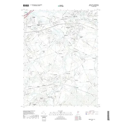
2019 Map of Mount Holly
USGS Topo · Published 2019About this map
Mount Holly serves as the focal point of this New Jersey landscape, situated where the North Branch Rancocas Creek meets the South Branch Rancocas Creek. The terrain is defined by a dense network of waterways and early industrial sites, including the prominent Kirbys Mill and the Vincentown Millpond further east. The map reveals a high concentration of established cemeteries and historical crossroads, reflecting centuries of settlement and community growth in Burlington County. To the north, the planned character of Smithville and its namesake Smithville Lake stand in contrast to the residential expansion seen in Rancocas Woods and Masonville. Transportation infrastructure is a dominant theme, from the path of the New Jersey Tpke to local aviation at the South Jersey Regional Airport and Flying W Airport. This survey provides a clear view of the suburban and industrial evolution of the region as it appeared in 2019, bridging traditional mill towns with modern developments.
Find a feature on this map
60 named features on this map. Tap any name to fly to it.
Don’t see what you’re looking for? This feature index may not catch every label — zoom into the map to look around manually.
Map Details
Editions of this 2019 Mount Holly Map
This is the sole edition of this map. No revisions or reprints were ever made.
Other maps of this area

1888 · Bordentown
USGS Topo · 1:62,500

1888 · Pemberton
USGS Topo · 1:62,500

1888 · Mount Holly
USGS Topo · 1:62,500

1890 · Burlington
USGS Topo · 1:62,500

1893 · Bordentown
USGS Topo · 1:62,500

1893 · Burlington
USGS Topo · 1:62,500

1894 · Pemberton
USGS Topo · 1:62,500

1894 · Mount Holly
USGS Topo · 1:62,500

1898 · Pemberton
USGS Topo · 1:62,500

1898 · Mount Holly
USGS Topo · 1:62,500
Featured Places
- Mount Laurel Township, NJ
- Willingboro Township, NJ
- Medford Township, NJ
- Lumberton Township, NJ
- Mount Holly Township, NJ