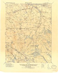
1919 Map of Mount Holly
USGS Topo · Published 1921About this map
Rancocas Creek and its complex network of branches dominate this landscape in Burlington County, providing the water power essential to the area's early industrial foundation. Local commerce is anchored by several prominent processing sites including Kirby's Mill, Ballinger's Mill, and Braddock Mill, while the low-lying wetlands are utilized for seasonal harvests at the West Jersey Cranberry Meadow and Jobstown Bog.
Find a feature on this map
114 named features on this map. Tap any name to fly to it.
Don’t see what you’re looking for? This feature index may not catch every label — zoom into the map to look around manually.
Map Details
Editions of this 1919 Mount Holly Map
This is the sole edition of this map. No revisions or reprints were ever made.
Other maps of this area

1888 · Bordentown
USGS Topo · 1:62,500

1888 · Pemberton
USGS Topo · 1:62,500

1888 · Mount Holly
USGS Topo · 1:62,500

1890 · Hammonton
USGS Topo · 1:62,500

1890 · Burlington
USGS Topo · 1:62,500

1890 · Mullica
USGS Topo · 1:62,500

1890 · Glassboro
USGS Topo · 1:62,500

1891 · Philadelphia
USGS Topo · 1:62,500

1893 · Germantown
USGS Topo · 1:62,500

1893 · Bordentown
USGS Topo · 1:62,500
Featured Places
- Cherry Hill Township, NJ
- Mount Laurel Township, NJ
- Winslow Township, NJ
- Willingboro Township, NJ
- Voorhees Township, NJ