2022 Map of Mount Hope
USGS Topo · Published 2022About this map
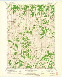
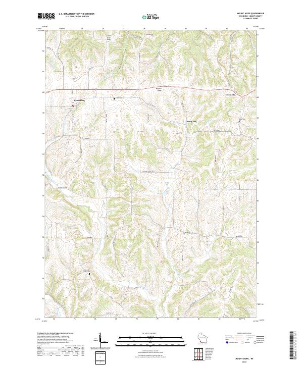
Military Ridge serves as the prominent east-west spine of this Grant County landscape, separating the northward-flowing waters of the Little Green River from the south-reaching drainages of the Little Grant River. The settlement of Mount Hope occupies a central position at the intersection of several regional routes, while Mount Ida sits to the east along the ridge line. The topography is defined by the Driftless Area's characteristic high ridges and deep valleys, such as Foxboro Hollow and Irish Ridge, which have dictated the placement of homesteads and winding roads like Pleasant Valley Rd.
Find a feature on this map
59 named features on this map. Tap any name to fly to it.
Don’t see what you’re looking for? This feature index may not catch every label — zoom into the map to look around manually.
Map Details
Editions of this 2022 Mount Hope Map
This is the sole edition of this map. No revisions or reprints were ever made.