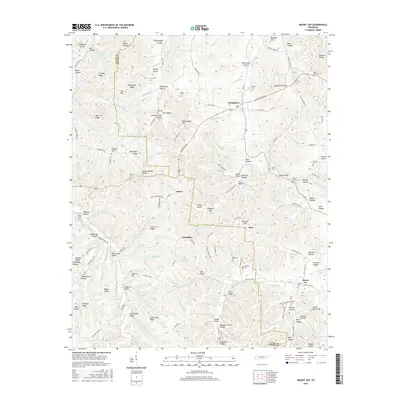
2016 Map of Mount Joy
USGS Topo · Published 2016About this map
Hampshire serves as a central hub on this landscape where the boundaries of Lewis Co and Maury Co converge. The terrain is defined by a dense network of ridges and hollows, including Whiteside Ridge and Hampshire Ridge, which dictate the winding paths of roads like the Hampshire Pike. Smaller settlements such as Aethra, Bachelder, and Seth are scattered across the interior, often situated near water sources like Big Swan Cr or Catheys Cr. For those researching local family histories, the map identifies numerous small burial grounds including Isom Cem, Pugh Cem, and Beech Hill Cem. The presence of features like Rock Hole Bluff and Hamilton Lakes indicates a geography shaped by both natural elevation and local water management, illustrating the rural character of this Tennessee region in the mid-2010s.
Find a feature on this map
155 named features on this map. Tap any name to fly to it.
Don’t see what you’re looking for? This feature index may not catch every label — zoom into the map to look around manually.
Map Details
Editions of this 2016 Mount Joy Map
This is the sole edition of this map. No revisions or reprints were ever made.
Other maps of this area

1901 · Colombia
USGS Topo · 1:125,000

1936 · Sandy Hook
USGS Topo · 1:24,000

1936 · Williamsport
USGS Topo · 1:24,000

1936 · Mt Joy
USGS Topo · 1:24,000

1936 · Henryville
USGS Topo · 1:24,000

1936 · Sunrise
USGS Topo · 1:24,000

1936 · Crestview
USGS Topo · 1:24,000

1936 · Greenfield Bend
USGS Topo · 1:24,000

1936 · Mount Pleasant
USGS Topo · 1:24,000

1936 · Gordonsburg
USGS Topo · 1:24,000