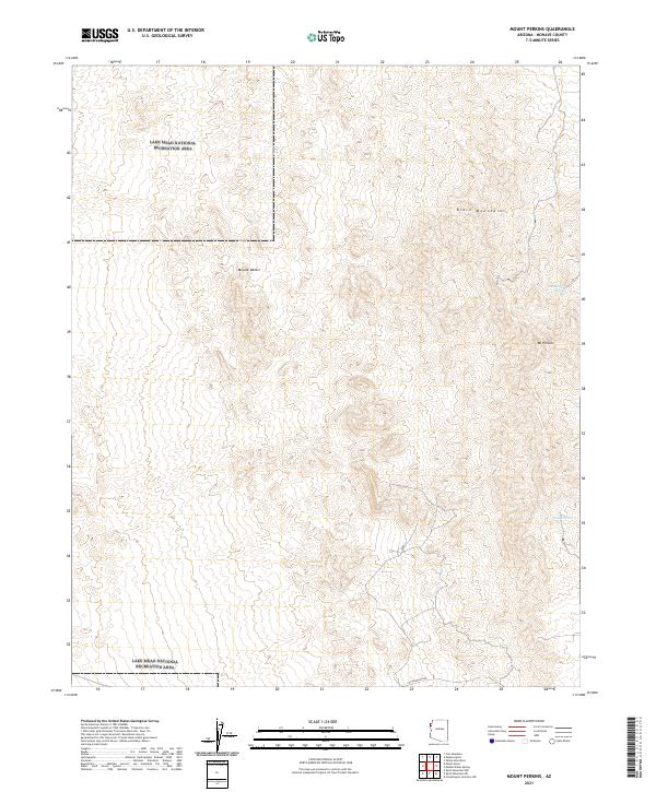
2021 Map of Mount Perkins
USGS Topo · Published 2021About this map
The Black Mountains dominate this high-desert landscape in northwestern Arizona, rising sharply above the eastern reaches of the Mojave Desert. The map centers on the high point of Mt Perkins, a landmark that anchors the surrounding terrain of deep washes and ridges. Portions of the western and southern sections fall within the Lake Mead National Recreation Area, reflecting the transition from managed wilderness to public lands. Occasional water sources, such as Cottonwood Spring and Coyote Spring, mark critical points in an otherwise arid environment where elevation changes are the defining characteristic. The only significant named thoroughfare, Cottonwood Rd, skirts the southern boundary, providing one of the few access points into this corner of Mohave County.
Find a feature on this map
13 named features on this map. Tap any name to fly to it.
Don’t see what you’re looking for? This feature index may not catch every label — zoom into the map to look around manually.
Map Details
Editions of this 2021 Mount Perkins Map
This is the sole edition of this map. No revisions or reprints were ever made.
Other maps of this area

1886 · Camp Mohave
USGS Topo · 1:250,000

1892 · Camp Mohave
USGS Topo · 1:250,000

1926 · Nelson
USGS Topo · 1:96,000

1926 · Mohave City
USGS Topo · 1:96,000

1942 · Camp Mohave
USGS Topo · 1:250,000

1947 · Kingman
USGS Topo · 1:250,000

1948 · Kingman
USGS Topo · 1:250,000

1954 · Kingman
USGS Topo · 1:250,000

1955 · Kingman
USGS Topo · 1:250,000

1958 · Kingman
USGS Topo · 1:250,000