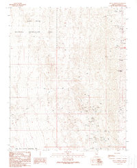
1989 Map of Mount Perkins
USGS Topo · Published 1990About this map
Mining operations and the desert shoreline of Lake Mead dominate this Mohave County landscape, where the Lake Mead National Recreation Area meets the high ground of Mount Perkins. The terrain is marked by a dense concentration of mineral exploration, particularly evident in the southern reaches where the Golden Door (Mine), Klondyke Mine, and Dixie Gold Mine are clustered near Cottonwood Road. These sites, along with the Dixie Queen Mine and numerous unnamed adits and prospects, suggest a period of intense prospecting activity in the Black Mountains region.
Find a feature on this map
28 named features on this map. Tap any name to fly to it.
Don’t see what you’re looking for? This feature index may not catch every label — zoom into the map to look around manually.
Map Details
Editions of this 1989 Mount Perkins Map
This is the sole edition of this map. No revisions or reprints were ever made.
Other maps of this area

1886 · Camp Mohave
USGS Topo · 1:250,000

1892 · Camp Mohave
USGS Topo · 1:250,000

1926 · Nelson
USGS Topo · 1:96,000

1926 · Mohave City
USGS Topo · 1:96,000

1942 · Camp Mohave
USGS Topo · 1:250,000

1947 · Kingman
USGS Topo · 1:250,000

1948 · Kingman
USGS Topo · 1:250,000

1954 · Kingman
USGS Topo · 1:250,000

1955 · Kingman
USGS Topo · 1:250,000

1958 · Kingman
USGS Topo · 1:250,000