2024 Map of Mount Vernon
USGS Topo · Published 2024About this map
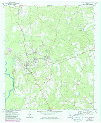
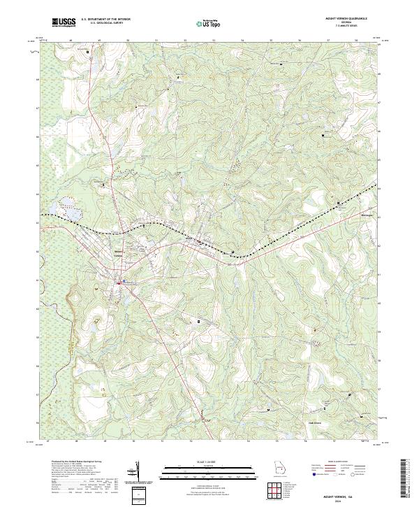
Mount Vernon serves as the focal point of this Montgomery County landscape, anchored by the Montgomery County Courthouse and the campus of Brewton-Parker College. The terrain is defined by the western flow of the Oconee River, which forms the border with Wheeler County, while numerous drainage systems like Flat Creek and Limestone Creek carve through the agricultural and timber lands. To the east, the neighboring settlement of Ailey sits along the primary transport corridor that links these communities to McGregor.
Find a feature on this map
102 named features on this map. Tap any name to fly to it.
Don’t see what you’re looking for? This feature index may not catch every label — zoom into the map to look around manually.
Map Details
Editions of this 2024 Mount Vernon Map
This is the sole edition of this map. No revisions or reprints were ever made.