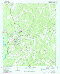
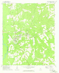
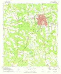
1970 Map of Mount Vernon
USGS Topo · Published 1986About this map
The town of Mount Vernon serves as a central hub on this Montgomery County landscape, where the campus of Brewton Parker College and the local High Sch sit adjacent to the regional rail corridor. The Seaboard Coast Line railroad runs southwest to northeast, passing through the neighboring settlement of Ailey and the community at McGregor. This transportation artery facilitated the local economy, connecting these rural centers to wider markets during the mid-to-late 20th century.
Find a feature on this map
35 named features on this map. Tap any name to fly to it.
Don’t see what you’re looking for? This feature index may not catch every label — zoom into the map to look around manually.
Map Details
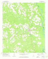
Editions of this 1970 Mount Vernon Map
2 editions found
Other maps of this area

1957 · Macon
USGS Topo · 1:250,000

1958 · Macon
USGS Topo · 1:250,000

1964 · Macon
USGS Topo · 1:250,000
1970 · Glenwood
USGS Topo · 1:24,000
1970 · Alston
USGS Topo · 1:24,000
1970 · Oak Park SW
USGS Topo · 1:24,000
1970 · Mount Vernon
USGS Topo · 1:24,000
1970 · Vidalia
USGS Topo · 1:24,000
1970 · Uvalda
USGS Topo · 1:24,000
1970 · Jordan
USGS Topo · 1:24,000