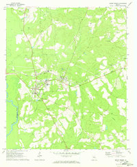
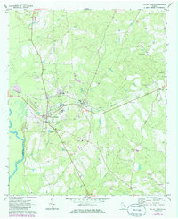
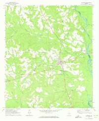
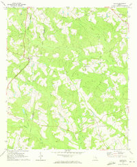
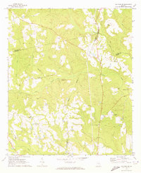
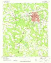
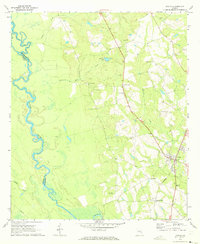
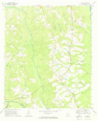
1970 Map of Mount Vernon
USGS Topo · Published 1973About this map
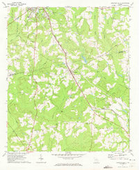
Brewton Parker College stands as a focal point of this Montgomery County landscape, situated between the growing settlements of Mount Vernon and Ailey. The 1970 landscape is defined by the Seaboard Coast Line railroad, which bisects the map and connects these communities to McGregor to the east. The terrain transitions from the broad Flat and the winding Oconee River on the western boundary to a network of smaller drainages like Bear Creek, Limestone Creek, and Lotts Creek. Numerous family-named burial sites, such as the McRae Cems, Peterson Cem, and Grove-Sharpe Cem, are scattered across the rural acreage, providing significant value for genealogists tracing local lineages. Educational and spiritual anchors like the County Training Sch, Mt Mariah Ch, and St Marys Ch further illustrate the established community structure of the era.
Find a feature on this map
36 named features on this map. Tap any name to fly to it.
Don’t see what you’re looking for? This feature index may not catch every label — zoom into the map to look around manually.
Map Details
Editions of this 1970 Mount Vernon Map
2 editions found
Other maps of this area

1957 · Macon
USGS Topo · 1:250,000

1958 · Macon
USGS Topo · 1:250,000

1964 · Macon
USGS Topo · 1:250,000
1970 · Glenwood
USGS Topo · 1:24,000
1970 · Alston
USGS Topo · 1:24,000
1970 · Oak Park SW
USGS Topo · 1:24,000
1970 · Vidalia
USGS Topo · 1:24,000
1970 · Uvalda
USGS Topo · 1:24,000
1970 · Jordan
USGS Topo · 1:24,000
1971 · Soperton South
USGS Topo · 1:24,000