2023 Map of Mount Victory
USGS Topo · Published 2023About this map
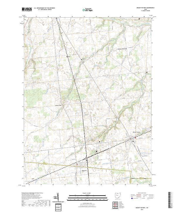
Mount Victory and Ridgeway anchor this rural landscape in south-central Hardin County, where the terrain is defined by a dense network of small waterways and drainage runs. The map shows the transition into northern Logan and Union counties, marked by the courses of Wolf Creek and Panther Creek. The settlement pattern follows a grid of township and county roads, connecting smaller named locales such as Mentzer, Grassy Point, and Browns Crossroads. Genealogists will find a high density of burial sites documented across these townships, including Mount Victory Cem, Ridgeway Cem, and several smaller locations like Hale Cem and Otterbein Cem. Along the southern reaches, Elliotts Landing sits near the confluence of South Wildcat Creek and North Wildcat Creek, illustrating how the local economy and geography remain tied to the headwaters of the Scioto River watershed.
Find a feature on this map
67 named features on this map. Tap any name to fly to it.
Don’t see what you’re looking for? This feature index may not catch every label — zoom into the map to look around manually.
Map Details
Editions of this 2023 Mount Victory Map
This is the sole edition of this map. No revisions or reprints were ever made.
Historical Maps of Buck Township Through Time
1 maps found