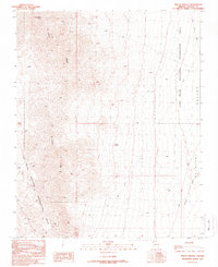
1989 Map of Mount Wilson
USGS Topo · Published 1990About this map
Mount Wilson dominates the high desert landscape in this late-twentieth-century topographical study, serving as a prominent anchor for the long spine of Wilson Ridge. This arid environment in Northwest Arizona is defined by the contrast between high peaks and the broad, low expanse of the Detrital Valley to the east. Within the Lake Mead National Recreation Area, evidence of resource extraction and water management appears in the form of the Two B's Mine and Cruick Dam, showing how the land was utilized during the mid-to-late 1900s. The presence of Temple Bar Road and an Overlook suggests the area's transition into a destination for managed recreation and sightseeing, while the drainage of Detrital Wash remains a central geological feature of the valley floor.
Find a feature on this map
14 named features on this map. Tap any name to fly to it.
Don’t see what you’re looking for? This feature index may not catch every label — zoom into the map to look around manually.
Map Details
Editions of this 1989 Mount Wilson Map
This is the sole edition of this map. No revisions or reprints were ever made.
Other maps of this area

1886 · Camp Mohave
USGS Topo · 1:250,000

1886 · Saint Thomas
USGS Topo · 1:250,000

1892 · Camp Mohave
USGS Topo · 1:250,000

1893 · Saint Thomas
USGS Topo · 1:250,000

1926 · Nelson
USGS Topo · 1:96,000

1926 · Bonelli
USGS Topo · 1:96,000

1926 · Boulder Canyon
USGS Topo · 1:96,000

1942 · Camp Mohave
USGS Topo · 1:250,000

1947 · Kingman
USGS Topo · 1:250,000

1948 · Kingman
USGS Topo · 1:250,000