
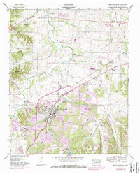
1936 Map of Mt Joy
USGS Topo · Published 1936About this map
Hampshire serves as a primary hub for this rural Tennessee landscape, situated where State Highway No 99 crosses the upper reaches of Catheys Creek. The map reveals a highly decentralized network of community life, where small settlements like Irad, Aethra, and Akin are defined more by their namesake country churches and schools than by dense town centers. This social fabric is grounded in local genealogy, with family names preserved in landmarks like Bingham Hill, McClanahan Hill, and Cothran Hill.
Find a feature on this map
54 named features on this map. Tap any name to fly to it.
Don’t see what you’re looking for? This feature index may not catch every label — zoom into the map to look around manually.
Map Details
Editions of this 1936 Mt Joy Map
This is the sole edition of this map. No revisions or reprints were ever made.
Other maps of this area

1901 · Colombia
USGS Topo · 1:125,000

1936 · Sandy Hook
USGS Topo · 1:24,000

1936 · Williamsport
USGS Topo · 1:24,000

1936 · Henryville
USGS Topo · 1:24,000

1936 · Sunrise
USGS Topo · 1:24,000

1936 · Crestview
USGS Topo · 1:24,000

1936 · Greenfield Bend
USGS Topo · 1:24,000

1936 · Mount Pleasant
USGS Topo · 1:24,000

1936 · Gordonsburg
USGS Topo · 1:24,000
1946 · Mount Pleasant
USGS Topo · 1:24,000