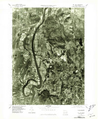
1975 Map of Mt Toby
USGS Topo · Published 1981About this map
Connecticut River bends and oxbows define this mid-1970s aerial perspective of the Pioneer Valley, where the fertile floodplains meet the rising slopes of Mt Toby. This orthophotograph, prepared from 1975 imagery, offers a rare photographic record of the landscape before significant modern development, showing the clear division between the concentrated village centers and the vast, patterned agricultural fields. From the larger settlement of South Deerfield in the northwest to the edge of Amherst in the southeast, the map documents the historic settlement patterns of Sunderland and the smaller hamlets of Russellville and North Hadley. The sharp contrast between the wooded heights and the silty banks of the river highlights the geographic constraints that shaped these Massachusetts towns, including Hatfield and its proximity to the winding Mill River.
Find a feature on this map
9 named features on this map. Tap any name to fly to it.
Don’t see what you’re looking for? This feature index may not catch every label — zoom into the map to look around manually.
Map Details
Editions of this 1975 Mt Toby Map
This is the sole edition of this map. No revisions or reprints were ever made.
Other maps of this area

1885 · Northampton
USGS Topo · 1:62,500

1886 · Northampton
USGS Topo · 1:62,500

1887 · Warwick
USGS Topo · 1:62,500

1887 · Belchertown
USGS Topo · 1:62,500

1889 · Warwick
USGS Topo · 1:62,500

1890 · Belchertown
USGS Topo · 1:62,500

1890 · Greenfield
USGS Topo · 1:62,500

1891 · Northampton
USGS Topo · 1:62,500

1893 · Northampton
USGS Topo · 1:62,500

1893 · Belchertown
USGS Topo · 1:62,500