
1967 Map of Mt. Trumbull NW
USGS Topo · Published 1971About this map
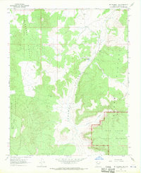
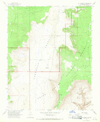
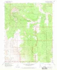
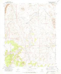
The high desert ranching landscape of the Unikaret Plateau is documented here as it appeared in the late 1960s. The map captures a transition between the rugged volcanic terrain of Mount Trumbull and the productive drainage basins of Sink Valley and Potato Valley. Family-named operations like Kenworthy Ranch, Marshall Ranch, and Craig Ranch are positioned near vital water sources such as Crosby Tank and Coyote Spring, illustrating the sparse but critical settlement pattern required for survival in this arid region of Mohave County. Within the Kaibab National Forest, the Nixon Ranger Station serves as a lone administrative outpost. The presence of a Landing Strip and various jeep trails alongside established water improvements like Sawmill Tank highlights the mid-century infrastructure supporting both forest management and private ranching interests across the Unikaret Mts.
Find a feature on this map
21 named features on this map. Tap any name to fly to it.
Don’t see what you’re looking for? This feature index may not catch every label — zoom into the map to look around manually.
Map Details
Editions of this 1967 Mt. Trumbull NW Map
This is the sole edition of this map. No revisions or reprints were ever made.
Other maps of this area

1886 · Mt. Trumbull
USGS Topo · 1:250,000

1892 · Mt. Trumbull
USGS Topo · 1:250,000

1953 · Grand Canyon
USGS Topo · 1:250,000

1957 · Grand Canyon
USGS Topo · 1:250,000

1958 · Grand Canyon
USGS Topo · 1:250,000

1960 · Grand Canyon
USGS Topo · 1:250,000
1967 · Mt. Trumbull NE
USGS Topo · 1:24,000
1967 · Mt. Trumbull SE
USGS Topo · 1:24,000
1967 · Mount Logan
USGS Topo · 1:24,000
1971 · Moriah Knoll
USGS Topo · 1:24,000