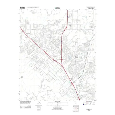
2012 Map of Murrieta
USGS Topo · Published 2012About this map
Murrieta Cr and Warm Springs Cr converge in a landscape defined by rapid suburban expansion and deep agricultural roots in Riverside County. This 2012 survey captures the area's transition into a major residential hub, as evidenced by large-scale planned developments like The Colony and the established estate character of Oak Springs Ranch. The legacy of the region's mineral waters is preserved at Murrieta Hot Springs, while newer industries are reflected in the presence of French Valley Vineyards and the Professional Golfers Career College. Notable landmarks such as Point Lookout and the Hogbacks provide topographic context for the valley, which is anchored by historical sites like Laurel Cem. Transportation is dominated by the modern layout of Murrieta Hot Springs Rd and Clinton Keith Rd, corridors that have replaced older rural paths.
Find a feature on this map
25 named features on this map. Tap any name to fly to it.
Don’t see what you’re looking for? This feature index may not catch every label — zoom into the map to look around manually.
Map Details
Editions of this 2012 Murrieta Map
This is the sole edition of this map. No revisions or reprints were ever made.
Other maps of this area

1901 · Southern California Sheet No. 1
USGS Topo · 1:250,000

1901 · Elsinore
USGS Topo · 1:125,000

1901 · San Luis Rey
USGS Topo · 1:125,000

1904 · Southern California Sheet No. 2
USGS Topo · 1:250,000

1904 · Southern California Sheet No. 1
USGS Topo · 1:250,000

1941 · Margarita Peak
USGS Topo · 1:62,500

1942 · Lake Elsinore
USGS Topo · 1:62,500

1942 · Margarita Peak
USGS Topo · 1:62,500

1942 · Temecula
USGS Topo · 1:62,500

1942 · Murrieta
USGS Topo · 1:62,500